Climbing Lascar – The Most Active Volcano in Northern Chile

WP_20150107_060
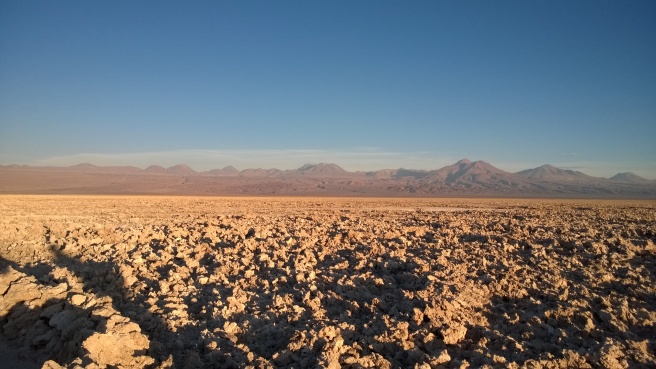
Lascar is in the center. Click image to enlarge. This is from the Salar de Atacama salt flats.

If you ever find yourself in the San Pedro de Atacama area of Chile, Lascar will prove to be an easy volcano to spot.  Its not the famously conical shaped one that everyone takes pictures of, that one is Licancabur.*   Lascar is the flat topped volcano streaked with white.  The white streaks aren’t snow (most of the time…occasionally it snows too) but are sulfur deposits.  Also, on most mornings you can see a small cloud over Lascar, due to the fact that Lascar is an active volcano.

Licancabur volcano summit chile ii region
Licancabur – very symmetrical. Not very climbable, what with the landmines…

Not only is Lascar active, it is the most active volcano in Northern Chile.  Its volcanism is the cause of one of the strangest climbing difficulties I’ve ever heard of: toxic clouds of sulfur.  If the wind is coming from across the crater the hike can get very unpleasant.  It is sometimes so bad that the hike can’t be accomplished.

Continue reading

Copa Coya: The Greatest Hike Ever?

Earlier this year I had the opportunity to travel to the Atacama Desert in Chile.  Many hikes were had.  Many were awesome.  This one was probably the most awesome.

WP_20150110_003

WP_20150110_002

Copa Coya is an almost volcano.  It tried, but never quite made it.  Evidence of its attempt include geothermal springs and geysers nearby.  If you’re touring the Atacama a lot of groups visit Copa Coya just for the geysers and springs.  If you’re into hiking, skip the geysers and go for the hike.  You can always take a dip in the hot springs after the hike. Continue reading

How I learned to love hiking

This story takes place back in 2012, which as I type this I recognize as not being all that long ago.  And yet that year marked the point at which I began transitioning from a person who enjoys walks to a person who enjoys hikes.

What is the difference between the two you say? (Humor me.  This is what you are saying)

Well…I suppose it depends upon who you ask.

Continue reading

Ice Caves Trail – or the trail that Equestrians Ruined.

I’ve thought about how to frame this post for awhile.  Wren and I hiked it back in Show Low, AZ on February 20th and the trail was in a sad state of affairs as a result of inconsiderate equestrian use.

So, do I post an angry rant?  No, I’m not mad so that would be contrived.  Somber perhaps? Mourn the death of what was once glorious?  No, neither am I sad – and honestly the trail was probably never the pinnacle of excellence.

So – what I’ll try to stick the facts:

Continue reading

Ghost of the Coyote Trail #641

Ghost of the Coyote is the best name I have ever seen for a trail.  Texas really liked to name trails “Golden Warbler Trail,” I’ve hiked at least 4 different Golden Warbler Trails and to the best of my minimal bird-watching knowledge have not seen this endangered species on any of them.  Sure – I didn’t see any Ghost Coyotes on this trail – but isn’t that the point of it being a ghost?  There was a bit of coyote scat…so that is probably close enough.

This trail is located in the White Mountain Trail System in Arizona and its interesting in that multiple sources disagree on length.  The WMTS website seems to think it is 16 miles, another source says 13 miles, and the Forest Service (the trail is located in the Apache-Sitgreaves National Forest) says 15 miles.

Well – in order to add to the confusion, my GPS says 14 miles.  Although – I did take two unmarked spurs that lead to great vistas.  Which lends credence to the 13 mile number.

Continue reading

A quick summary of my journey so far:

What follows is a rough outline of my RV trip thus far.  I’ll go into more detail about what exactly the RV trip is, and is not, or will be, or won’t be, or something – just not right now.

January 29 – Hotel Ella in Austin, TX. RV was in shop getting LP leak fixed, and BMW had blown charge line fuse.

January 30-Feb2 – Fort Parker State Park in Mexia, TX (Meh-Hee-Ah). Canoed up Navasota River (13 mi) to Civil War Reunion Site. Hiked ~ 5 miles from dam. Excellent camp ground, very few campers. Threatened to rain lots, did not. Eagle, pelicans, many armadillo, sow and piglets

February 3-4 – Aggieland RV Park in Bryan, TX. Packed up apartment. Rained entire time.

Continue reading